Historical Marker
Fort Anahuac
National Register listing
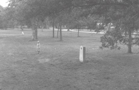
Marker Located at Fort Anahuac Park
Resource Name: Fort Anahuac
Resource Type: SITE
Certification: LISTED IN THE NATIONAL REGISTER
Certification Date: 19810701
Significance Level: STATE
Significant Year: 1836
Cultural Affiliation: Mexican,military; American,military
Architect: Republic of Mexico
Applicable Criteria: EVENT; INFORMATION POTENTIAL
Area Significance: HISTORIC - NON-ABORIGINAL; MILITARY; EXPLORATION/SETTLEMENT; POLITICS/GOVERNMENT
Current Function: LANDSCAPE
Subfunction: PARK
Historic Function: DEFENSE
Historic Subfunction: MILITARY FACILITY
Foundation: BRICK
Wall: NONE LISTED
Roof: NONE LISTED
Period: 1825-1849
Narrative:
Fort Anahuac Site is located about one mile south of the center of Anahuac in a county park which borders State Highway 564. The fort represents an 1830's Mexican Garrison and Customs House, strategically located to control access to east Texas and the Trinity River.
The fort was constructed at the edge of an upper terrace of the delta of the Trinity River, overlooking a 15 foot ledge above Trinity Bay. Trinity Bay in turn is part of, and at the northern end of, Galveston Bay. The terrace is part of a Pleistocene fluvial-deltaic system composed of meander- sands, with forest cover. Just below the terrace at the edge of the bay is a modern fluvialdeltaic system composed of levee deposits of silt, mud, and sand. The physical properties of the soil have been described as clayey sands and silts with moderate permeability, drainage, and water holding capacity. Compression and shrink-swell capacities are low to moderate while shear strength is high. Topographical the area is described as having level relief with minor mounds and ridges. Flora is dominated by mixed pines and hardwoods and fauna consists of mammals, reptiles, and abundant water fowl. Originally, the site of Fort Anahuac consisted of a large cleared tract containing brick walls and defense lines, a surrounding ditch, wooden stockades and structures, a small customs house and related brick kilns. Also mentioned were two underground passage ways to a magazine in the hillside 40 yards from the fortifications (Clay & n.d.:7). After abandonment by Mexican troops in 1832 local residents apparently carried away or burned all wooden houses and barracks and slowly started pulling out bricks from the walls(Ibid). A 1938 sketch outline of the premises was made by a surveyor, after which all exposed foundations were covered over. In the mid-1960's some excavations were conducted by the Southwestern Historical Exploration Society of Houston but these works were also covered due to subsequent vandalism. Two walls were partially exposed and approximately 24 inches of brick work were identified. The only other organized work at the site came in 1977 when the Texas Historical Commission conducted a surface magnetometer survey. A number of magnetic anomalies were located, but subsequent identification of these as to age has not occurred to date (1981). It has been previously mentioned that 75% of the site has been disturbed (previous nomination) and this is probably correct if one considers original walls and structures. Apparently however, foundations for the fortress, barracks, kilns, and other work areas may still exist and could be identified through careful archeological excavations. The site is currently part of a County Park, and therefore protected from plowing or construction activity. While brick construction has occasionally become visible at the surface, most of the site remains under ground cover. Fort Anahuac is now represented by only the foundations of its walls but the archeological deposits in the area are of the greatest significance in that they represent rare evidence of the brief Mexican Republic period of Texas history. Having been built and abandoned in that period the stratigraphic sequence should be easily interpreted. Difficulties often, found in accurately dating artifacts and features in sites of long occupation should not be encountered. The site is of great historic importance as the scene of the first serious agitation and armed conflict of the Texas Revolution.
Fort Anahuac was built by Mexico at the mouth of the Trinity River as a customs house and small fort in 1830 when Texas was still a Mexican state. The fort commanded the trade route to the early colonies of Anglo settlers in the Trinity River valley and was thus of great strategic, economic, and political as well as military importance. It was built by the small contingent of about 160 Mexican soldiers sent to be its garrison which was commanded by the infamous Col. Juan Davis Bradburn. Friction with the local settlers began when Col. Bradburn conscripted labor and materials to build the fort. The fort and nearby town of Anahuac was the scene of early agitation leading up to the Texas Revolution and for a time several prominent Texans including Patrick C. Jack and William B. Travis were imprisoned at the fort.
The fort originally had brick walls more than seven feet thick and had been built from a model given to Col. Bradburn by his superiors in Mexico. The fort armament consisted of two 18 lb. pivot guns. The barracks adjoining the fort had walls, about four feet thick. Aside from enforcing customs laws another purpose of the fort was to halt foreign immigration in accordance with a new law passed April 6, 1830. The local Anglo settlers resented the fort for both of these reasons as well as friction with soldier convicts who made up part of the garrison. Conflict between the settlers and the soldiers ensued.
Fort Anahuac has been called the "Birthplace of the Texas Revolution" and is of great historical importance for the following list of firsts which occurred there:
- Mexican authorities first unjustly jailed American colonists;
- The public first voiced opposition to unjust edicts;
- The first written resolutions-of-war (the Turtle Bayou Resolutions);
- The first to disregard Mexican martial law and take matters of civil rights into their own hands;
- The Texas navy's first action against Mexican forces;
- The first Texas marine assault on Mexican forces;
- Mexican soldiers first fired on an army of Texas colonists;
- The first Mexican soldier killed in action against Texas troops;
- And the first Texas soldier killed in action against Mexican troops.
Today the site of Fort Anahuac is a county park with historical markers to remind visitors of its historic nature. The county historical commission has plans for the archeological investigation of the fort and hopes subsequently to establish interpretive displays and exhibits.
It has been suggested that the nomination of the site be restricted to known features. At this time information on the size of Fort Anahuac is derived from the 1960's sub- surface excavations, occasional uncovered wall sections, and historic records. The 1977 magnetometer survey indicated the possibility of features outside of the section being nominated, but excavations have not defined any of these. It is felt that in the interest of preservation, only the area noted in section 10 should be nominated, with potential amendments to the site size coming if and when proper testing can be arranged. The rectangle defined in this nomination contains the remains of known fort foundations, the possible remains of the brick kilns used to build the walls, and scattered brick foundations that may represent barracks on the northwest end of the fort. A copy of the 1968 sketch of the fort layout (Lewis 1968) according to Southwestern Historical Exploration Society excavations will help explain the northern boundary.
BIBLIOGRAPHY ON FILE IN THE NATIONAL REGISTER.